New Dataset Highlights
While much of the work of the Open Data Coordinators and Open Data Team is maintaining and promoting existing datasets, new datasets are being continually created and published as City operations evolve and new technology is acquired. Over the past year, more than 400 datasets were published by over 60 different agencies. The current list of datasets and when they were published is available in our asset inventory and some recently published highlights are below:
NYC Clean Soil Bank Generating and Receiving Sites
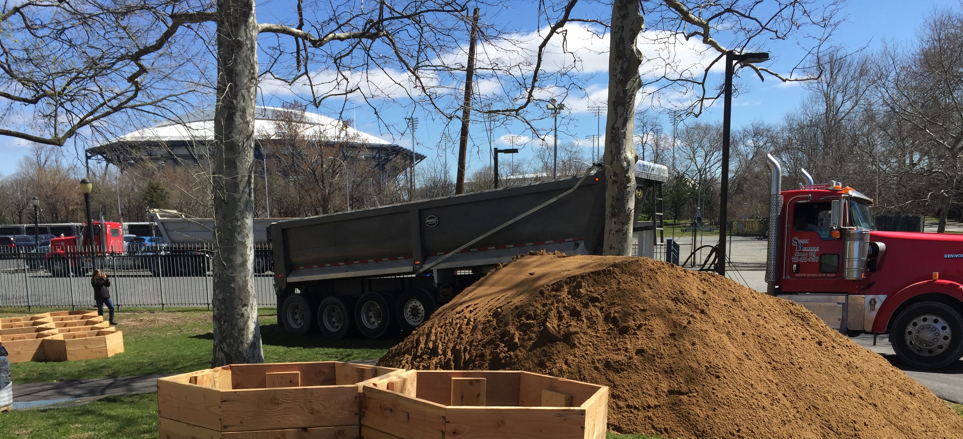
The Mayor’s Office of Environmental Remediation’s (MOER) NYC Clean Soil Bank recycles clean, native soil from deep excavations at construction sites undergoing environmental cleanup in NYC to City capital projects, other cleanup sites, and community gardens. This program, made possible through an agreement with the New York State Department of Environmental Conservation, keeps clean soil in the city rather than shipping it beyond the city for disposal and provides projects with clean soil to adjust land elevation, build wetlands, prevent lead exposure, and fortify shorelines.
This dataset features both the generating and receiving sites affiliated with this program. Generating sites must meet certain environmental standards, while receiving sites include public construction projects, projects that advance social equity goals, and projects that remediate contaminated land. Both public and private sites within the City can apply to be part of the Clean Soil Bank.
Read more about the Clean Soil Bank program on the Mayor’s Office of Environmental Remediation website or view a map of these sites across the city.
Street Sign Work Orders
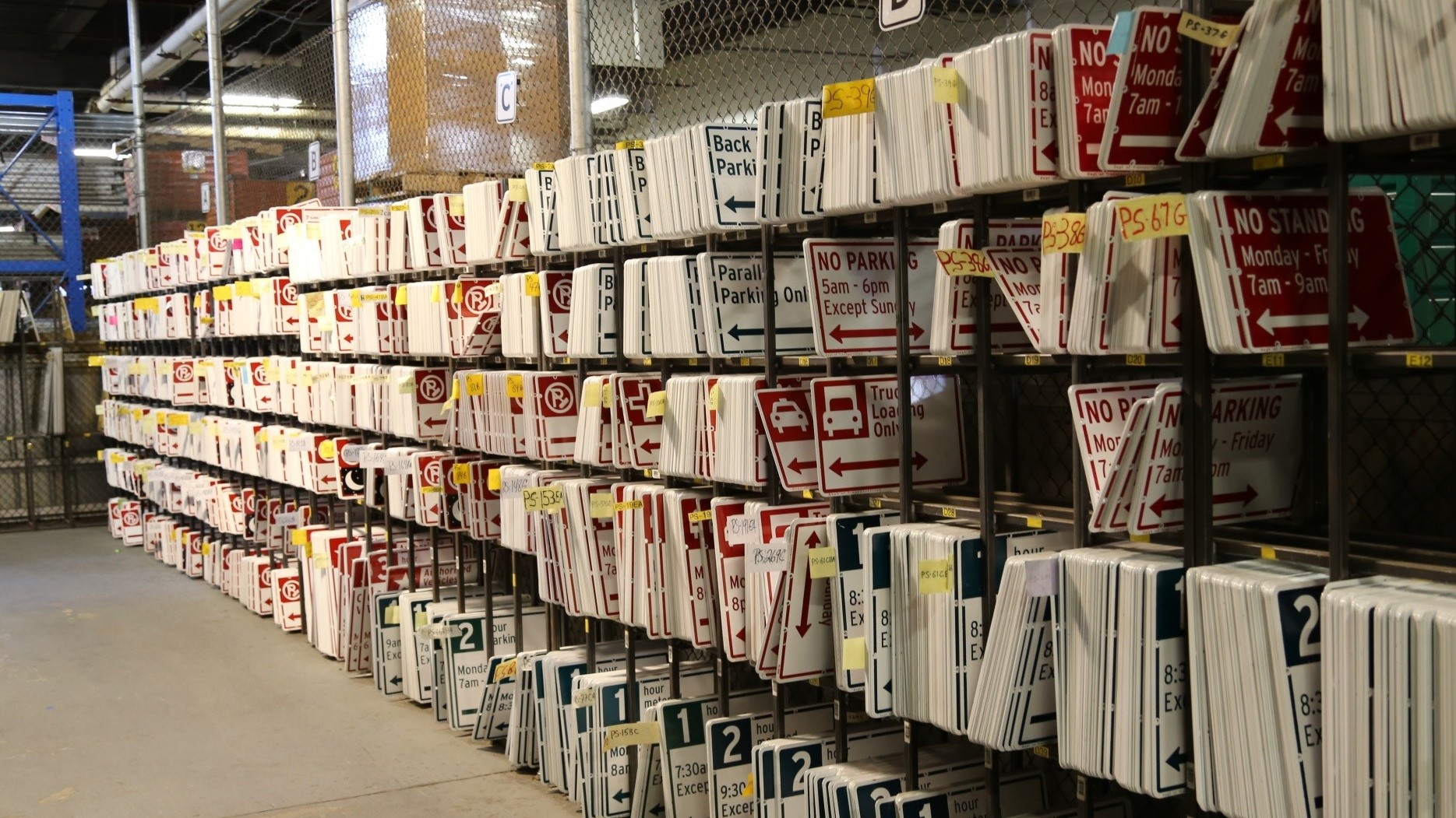
NYC’s Department of Transportation (DOT) manages approximately a million street signs across every road and neighborhood in New York City. The Street Sign Work Orders dataset contains information from the DOT Sign Information Management Systems (SIMS) which is an asset management system to track regulatory, warning and guide signs. The Traffic Control and Engineering Unit is responsible for operational and administrative tasks related to installation, maintenance, and removal of signs. The Street Sign Work Orders dataset offers sign details, installation dates, location, work order details and repair history.
This dataset can be used with the Street Name Sign Work Orders (which contains signage of street names as opposed to the regulation signs in this dataset), Parking Meter Locations, or Parking Meters ParkNYC- Blockfaces datasets to better understand the history of signage in a particular location. For more information about NYC’s street signs, visit the DOT’s traffic sign webpage.
Ethnic and Community Media Print, Digital, and Broadcast Outlet Directory
New York City is one of the most diverse cities in the United States, and the news publications New Yorkers read reflect that diversity. Community and Ethnic Media outlets are an important way for the City to make sure that all New Yorkers, including those with limited English proficiency or who are part of immigrant communities, are aware of City government programs and services. In 2019, Mayor de Blasio issued Executive Order 47, calling for City agencies to spend at least half of their overall advertising budgets with Community and Ethnic Media outlets. The directory of eligible outlets is available as a dataset and serves as a resource for agencies, listing more than 200 approved print and digital media outlets where agencies can direct their spending to comply with the executive order.
This directory displays the extensive range of communities served by local media outlets in the City. Anyone studying the dataset would better understand the breadth and depth of the City’s media landscape, especially as it pertains to communities of color and communities who speak another language. This summer, this work was codified into law, creating the Office of Ethnic and Community Media to ensure efforts to better reach every New Yorker continue.
To understand the impact of this program, visit the Community and Ethnic Media Agency Ad Spend dataset on Open Data, which shows agency expenditures and compliance with EO 47. Visit the Mayor’s Office of Media and Entertainment website to learn more about the Community and Ethnic Media program.

Cool It! NYC 2020 - Cooling Sites
Cool It! NYC is a citywide plan focused on increasing the number of cooling features available to the public during heat emergencies, particularly in neighborhoods vulnerable to the dangers of high heat. Last year, as the COVID-19 pandemic made gathering indoors risky, the mission of creating more outdoor cooling elements took on additional urgency. This dataset represents the hundreds of cooling features – including water sprayers, misters, and more that were activated as a part of this plan. These new cooling elements were installed using various existing water sources in parks, including drinking fountains and ground hydrants. To learn more, visit the interactive map of cooling sites across the city, which also includes information on tree canopy cover to show which streets and parks are leafiest.